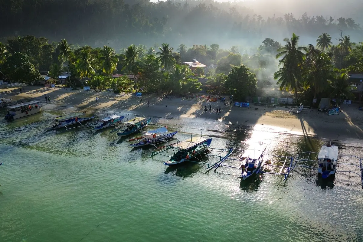
Palawan’s north-west coast, between Puerto Princesa and El Nido
San Vicente is more than Port Barton. The municipality’s main settlement and Long Beach sit farther north on Palawan’s west coast, with their own airport and a very different feel from the busy gateways at Puerto Princesa and El Nido. It is also a genuinely large municipality with a small population, which is why the coast reads as empty rather than built up — and why “San Vicente” and “Long Beach” are areas rather than addresses. It works as a base in its own right, or as a stop in a longer mainland itinerary.
San Vicente is a coastal municipality on the north-west side of mainland Palawan. Port Barton is one of its ten barangays, not the municipal centre.
It is bounded by the sea to the west, Taytay to the north, Roxas to the east and Puerto Princesa to the south — so it sits on the same mainland road corridor that links Puerto Princesa with El Nido.
The municipality was created on 21 June 1969 by Republic Act 5821 and began functioning separately on 1 January 1972. Its northern barangays were previously part of Taytay and its southern ones part of Puerto Princesa, which is why the municipality still reads as two halves joined by one coast road.
Long Beach follows the municipality’s west-facing coast through Poblacion, New Agutaya, San Isidro and Alimanguan, rather than being a single resort compound.
The national Department of Tourism describes Long Beach as the longest white-sand beach in the Philippines, at roughly 14.7 km; its open west-coast position also makes it a natural sunset beach.
Two rocky headlands interrupt that stretch, dividing it into three coves. At low tide you can walk around them along the sand, which is why the local government describes the beach as continuous.
San Vicente covers about 1,462.94 km² with a 2020 census population of 33,507 — roughly 23 people per square kilometre. The space between stays is a feature of the place, not a temporary stage of building it.
San Vicente is TIEZA’s first flagship Tourism Enterprise Zone, and its tourism master plan divides the municipality into four development clusters rather than one dense strip.
Twenty-two islands and islets lie within the municipality’s own waters, so there is a boat side to San Vicente as well as a beach one.
San Vicente Airport provides direct air access to the municipality. Overland, San Vicente connects into the mainland road corridor linking Puerto Princesa, Port Barton and El Nido.
The dry season runs roughly December to May and the wet season June to November. The north-east amihan prevails from November to May, while the south-west habagat brings rougher coastal water — which matters on a west-facing coast.
The municipality is named for San Vicente Ferrer and holds its town fiesta from 1 to 5 April, Foundation Day on 21 June and the Malagnang Festival from 17 to 21 June, after Malagnang — the settlement’s name before it was renamed.
Airport pickups are met in the arrivals area with a name board rather than at the kerb, and the written confirmation sent before you travel carries the driver and vehicle details.
The departure leg is quoted the same way: send the flight you are catching and the pickup is worked back from it rather than guessed, and where the timing is tight we will say plainly whether it works.
If the name board is not there when you land, stay in the arrivals area and message us rather than leaving the terminal or taking a taxi — the written confirmation sent before you travel carries the driver and vehicle details, so save it offline and use it. We would rather sort it out while you are standing there than hear about it afterwards.
Everything we arrange is in English, and we are the English-speaking end of it on the day as well as before it — if something moves, message us rather than trying to settle it at the roadside. We do not promise a particular driver’s fluency; instead the written confirmation carries the pickup, the driver and vehicle details and the shape of the day, so it is settled in writing rather than negotiated at a kerb.
Not booked your accommodation yet? Ask anyway — the town or the area you are aiming for is enough for us to quote the leg and tell you whether it works. The exact property belongs to the confirmation, not the enquiry: send it by reply as soon as you have it, and if the final address changes the trip materially we re-quote it rather than finding out on the day.
Stopping somewhere on the way is normal here, not a separate booking: the vehicle and driver stay with you through the stop and your luggage stays aboard, so list the stops in order on the quote form and we plan the day around them rather than leaving it to the roadside.
We publish facts, not fares. Prices depend on the vehicle or boat, your group size, waiting time and the season, so every trip is quoted individually — free and with no obligation.
What we can quote for San Vicente & Long Beach
San Vicente Airport pickups and drop-offs for Long Beach and nearby stays
Private transfers between Puerto Princesa and San Vicente
Onward private transfers from San Vicente to El Nido or Port Barton
Cars and vans with driver for Long Beach, Poblacion and the coastal barangays
Long Beach day trips from a Port Barton base, with the driver waiting
Drop-offs named by barangay — Poblacion, New Agutaya, San Isidro or Alimanguan — where road access allows
Multi-stop mainland itineraries that include San Vicente without backtracking
No. Port Barton is one of San Vicente’s ten barangays, not the municipal centre. The main settlement and Long Beach sit farther north on Palawan’s west coast and have a very different feel from Port Barton.
What exactly is Long Beach?
Long Beach follows the municipality’s west-facing coast through Poblacion, New Agutaya, San Isidro and Alimanguan, rather than being a single resort compound. The national Department of Tourism describes it as the longest white-sand beach in the Philippines, at roughly 14.7 km, and its open west-coast position makes it a natural sunset beach.
Is Long Beach one continuous beach?
Almost. Two rocky headlands interrupt the stretch and divide it into three coves, but at low tide you can walk around them along the sand — which is why the local government describes the beach as continuous. In practice it means the cove you stay on matters: it sets which stretch you can walk straight out onto.
What should I write on the form — “San Vicente” or “Long Beach”?
Either, as long as you add the barangay or the property name. Long Beach runs through Poblacion, New Agutaya, San Isidro and Alimanguan, so a driver needs to know which stretch of the coast you mean rather than only the beach name.
Why does San Vicente feel so empty?
Because it is. The municipality covers about 1,462.94 km² and had a population of 33,507 at the 2020 census — roughly 23 people per square kilometre. TIEZA’s master plan also spreads development across four clusters rather than concentrating it in one strip, so stays are deliberately spaced out along the coast.
Can I fly into San Vicente?
Yes. San Vicente Airport provides direct air access to the municipality. Overland, San Vicente connects into the mainland road corridor linking Puerto Princesa, Port Barton and El Nido, so it also works as a stop rather than only as a destination.
Is San Vicente a detour from the Puerto Princesa to El Nido road?
It does not have to be. San Vicente is bounded by Taytay to the north, Roxas to the east and Puerto Princesa to the south, sitting on the north-west mainland between the two gateways — so we normally quote it as a stop on a northbound or southbound transfer rather than as a separate return trip.
Are there islands off San Vicente?
Yes — twenty-two islands and islets lie within the municipality’s own waters, so there is a boat side to the area as well as a beach one. Boat trips themselves are arranged locally at the coast; what we quote is the road and airport side that gets you there.
What does San Vicente being a Tourism Enterprise Zone mean?
San Vicente is TIEZA’s first flagship Tourism Enterprise Zone. Its tourism master plan divides the municipality into four development clusters rather than one dense resort strip, which is the reason accommodation along Long Beach is spread out rather than gathered in a single centre.
When is the best time to visit Long Beach?
The dry season runs roughly December to May and the wet season June to November. The north-east amihan prevails from November to May, while the south-west habagat brings rougher coastal water — which matters more here than on a sheltered bay, because Long Beach faces west into open sea.
Is anything happening in town while I am there?
The municipality is named for San Vicente Ferrer and holds its town fiesta from 1 to 5 April, Foundation Day on 21 June and the Malagnang Festival from 17 to 21 June — named after Malagnang, what the settlement was called before it was renamed. Confirm the year’s programme locally, as the events around the fixed dates vary.
Anything specific to your dates, group or pickup point is answered on the quote — that is where the actual vehicle, timing and fixed all-in price come from.